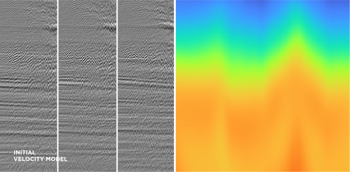
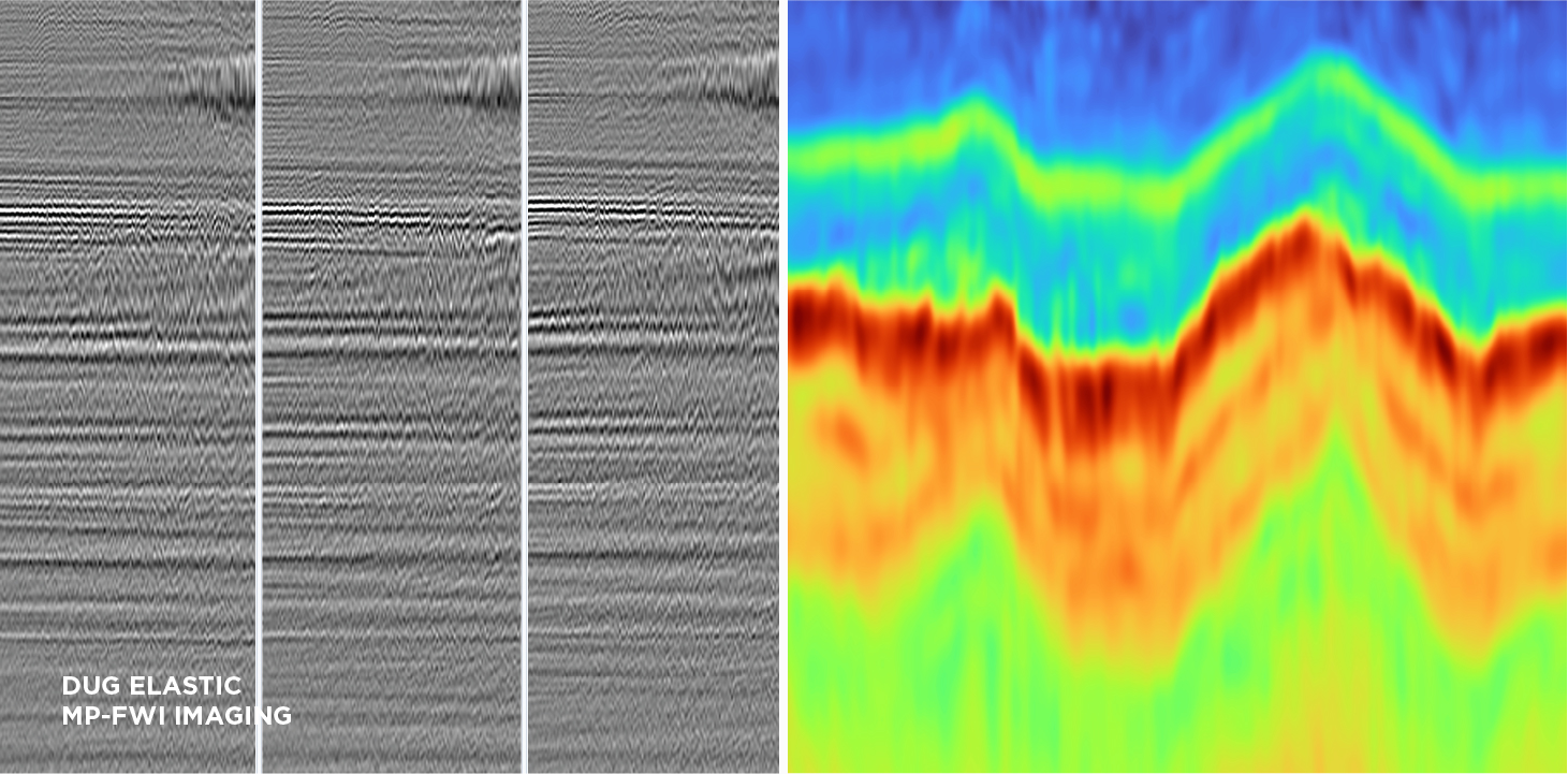
Here, velocity model updates generated using a conventional workflow and DUG Elastic MP-FWI Imaging were evaluated using a Kirchhoff pre-stack depth migration (KpreSDM), using the fully pre-processed data as input. The figure above compares common-offset-vector KpreSDM snail gathers using the initial velocity model and the DUG Elastic MP-FWI Imaging derived velocity model The MP-FWI imaging velocity model demonstrates a clear and significant kinematic improvement (gather flatness) and a reduction of jitter due to the azimuthal variations, particularly around the high-impedance contrasts given by the carbonates.
In these land dataset examples quite spectacular uplift was observed. DUG MP-FWI Imaging resolved subtle structural and stratigraphic features that were simply not imaged with a conventional processing and imaging workflow. Even with the additional complexity that comes with onshore data acquisition (such as topography and near-surface effects), DUG MP-FWI Imaging produced far superior results. Significantly better illumination and event continuity is obvious when comparing the sections below, thanks to least-squares imaging of the full wavefield—that includes interbed multiples. Incredible near-surface detail has been resolved, as can be seen on the shallow depth-slices to the right. This example highlights why DUG MP-FWI Imaging is now the technology of choice, and a must-have for any seismic project, either land or marine.
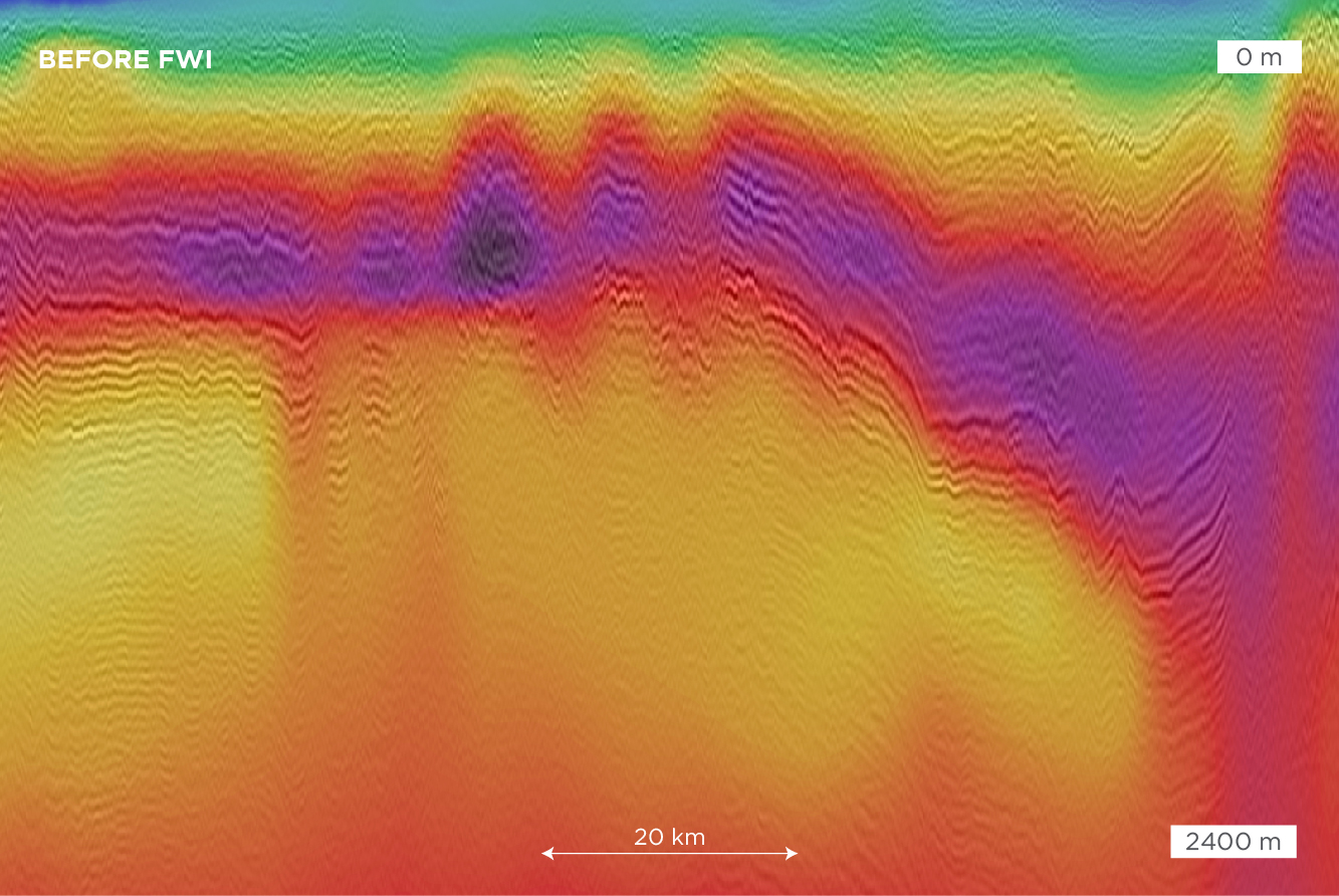
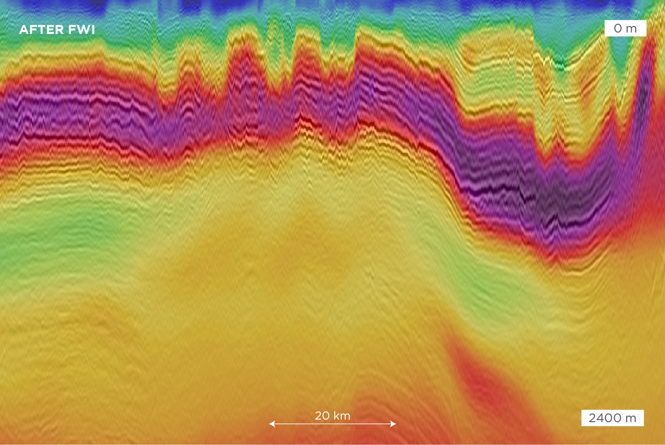
Migrated stack co-rendered and imaged with the velocity model prior to FWI versus migrated stack co-rendered and imaged with the FWI velocity model.
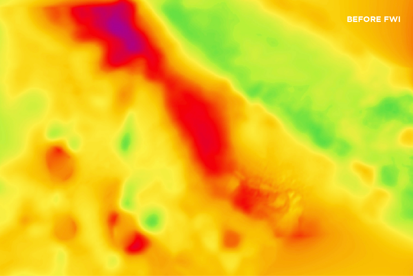
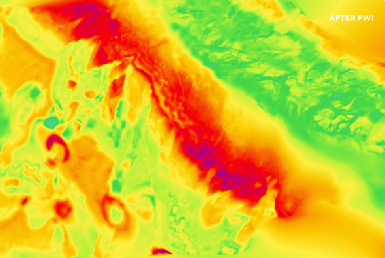
Shallow depth slice of the velocity model prior to FWI versus shallow depth slice of the velocity model after FWI highlighting significant short wavelength detail.
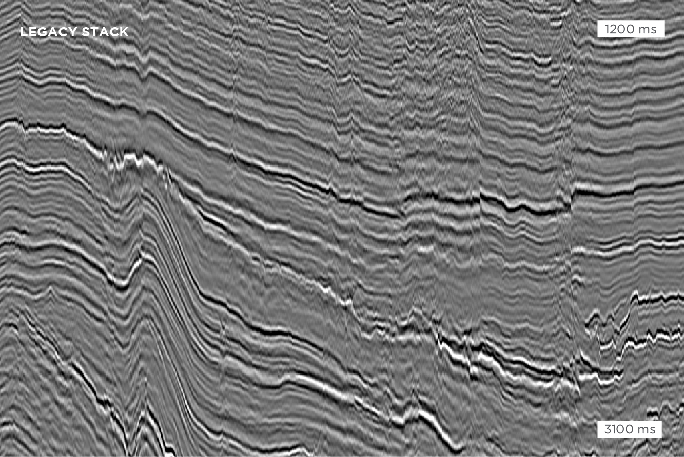
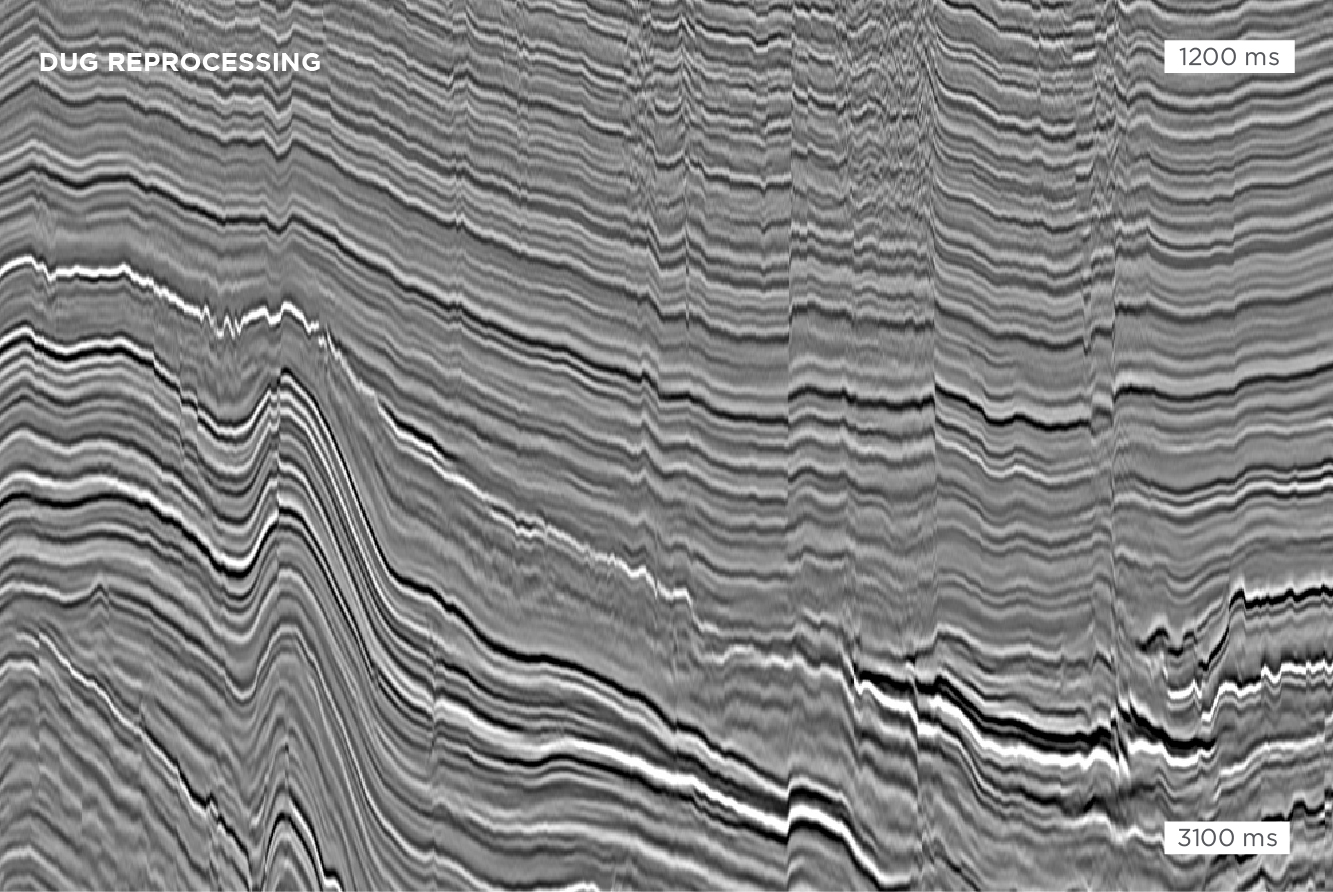
Legacy stack compared to DUG’s reprocessed result. As well as the imaging uplift provided by FWI, significant pre-processing improvements from cross-spread FKK noise removal and multiple suppression using true-azimuth 3D SRME were achieved.
In this onshore dataset, significant imaging improvements were obtained with our comprehensive, state-of-the-art pre-processing and velocity model-building workflow using FWI.
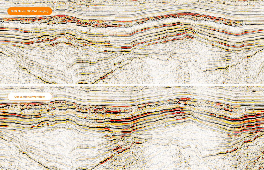
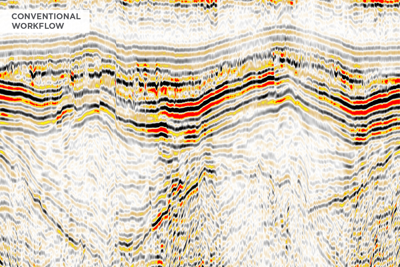
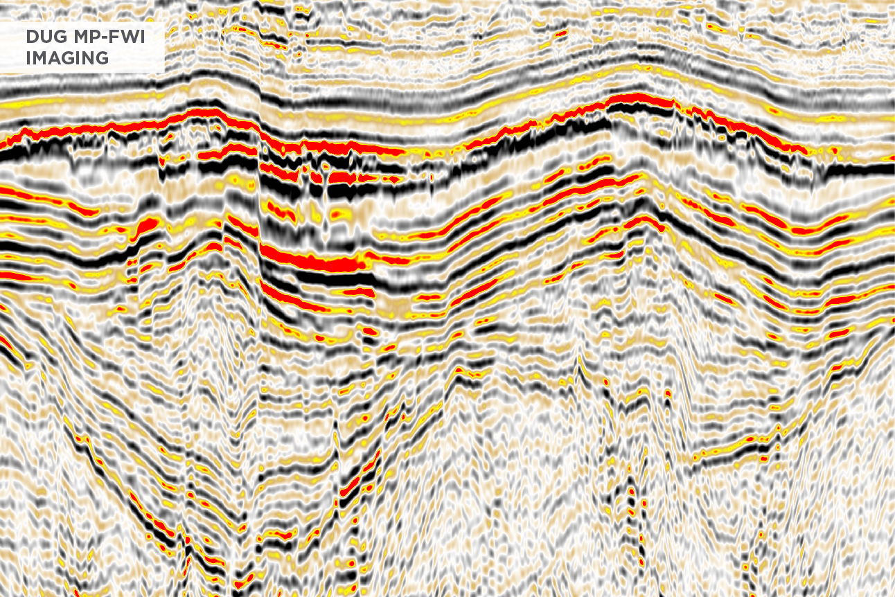
Working closely with our client, we were able to significantly improve the quality and resolution of existing data, allowing for a more accurate understanding of the subsurface geology. This area is characterised by faulted sequences of alternating clastics and carbonates, separated by several rugose unconformities.
This project comprised 10 surveys and over 10,500 square kilometres of data.
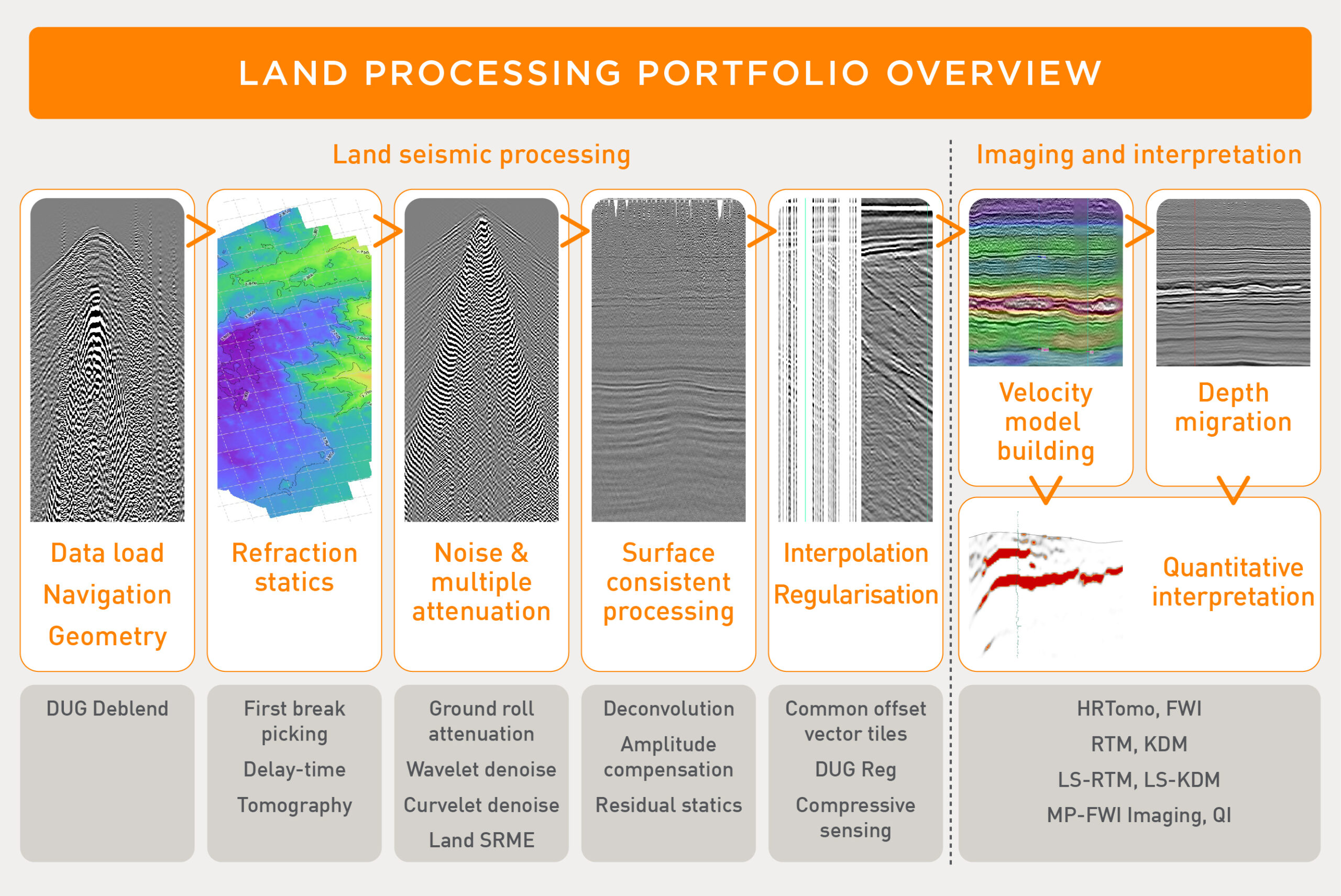
We offer a complete toolkit for modern, high-density land surveys.
DUG Deblend is our best-in-class inversion algorithm enabling both improvements in acquisition efficiency and increasing data quality.
Our technology spans solutions for statics, a wide variety of options for noise and multiple attenuation, full-azimuth processing and advanced reconstruction and regularisation algorithms which include support for compressive sensing. This is combined with our modern model building and imaging tookit including MP-FWI Imaging.
Data courtesy of Apache.
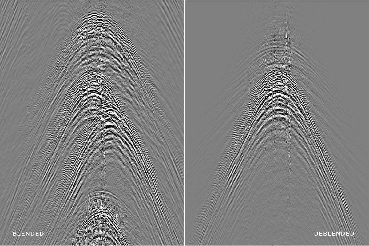
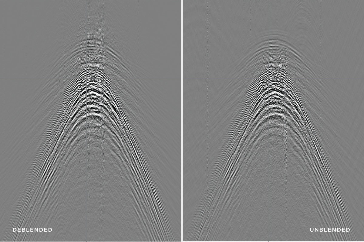
This land data set from onshore Egypt was acquired in a blended manner with up to 30 vibroseis units in operation at any one time. Each vibroseis unit worked on a separate source line, each over 20 km long resulting in a highly variable separation of sources. Subsequently, a source line was reacquired in a non-blended manner, absent of interfering shot energy to serve as a benchmark for deblending.
The results (right) compare the blended input data on the left, the DUG Deblend result in the centre and the benchmark, unblended data on the right. The non-blended dataset provides a powerful comparison highlighting the efficacy of our deblending solution. The deblended result could be argued to be an improvement over the unblended result due to the increase in signal-to-noise ratio that comes naturally from inversion-based deblending.