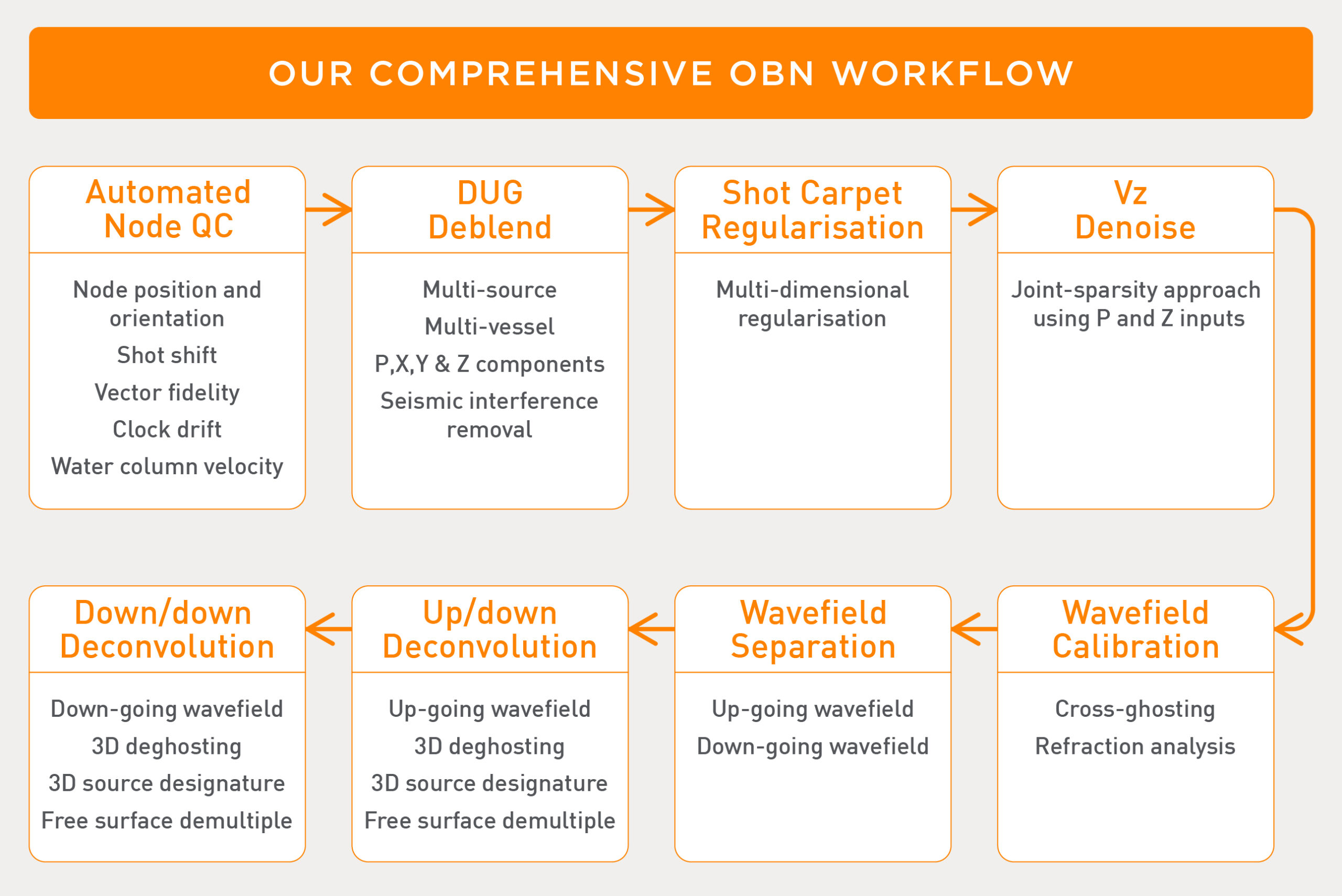
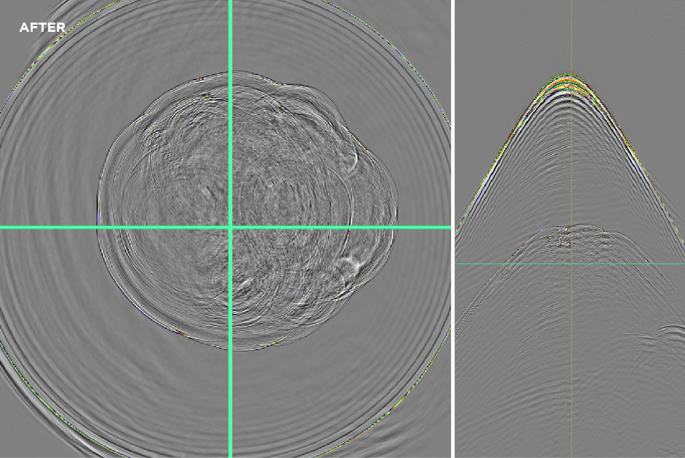
Highly efficient multi-vessel, multi-source OBS surveys are now a tried and tested reality thanks to DUG Deblend. Reap the benefits of rich azimuthal information with our advanced imaging algorithms, including Multi-parameter FWI.
Eliminate troublesome Vz noise with our patent-pending joint sparsity recovery approach. Harness the power of up/down deconvolution and, exclusively to DUG, down/down deconvolution to apply 3D deghosting, designature and demultiple in a single step to produce superior images with the down-going wavefield.
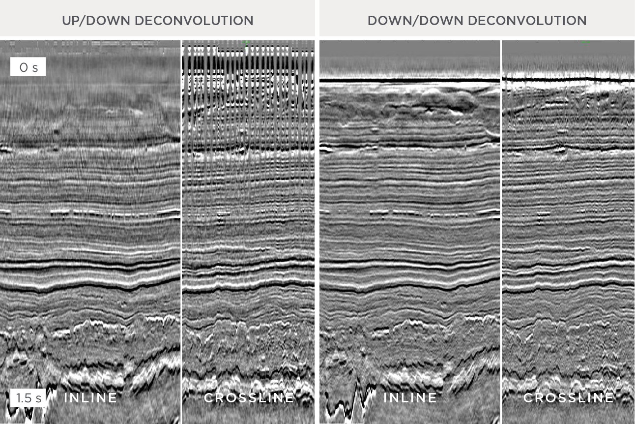

Up/down deconvolution using the upgoing wavefield (left) compared to down/down deconvolution using the down-going wavefield (right). The down-going wavefield can significantly improve near-surface imaging when processed with DUG’s exclusive down/down deconvolution algorithm. (Data courtesy of Carbon Transition and TGS)
Ocean bottom geophone data are often contaminated by shear-like noise (“Vz noise”). DUG’s (patent-pending) algorithm applies a distributed compressive sensing approach called joint sparsity recovery to P and Z data to perform up/down wavefield separation and isolation of the Vz noise. (Data courtesy of Carbon Transition and TGS)
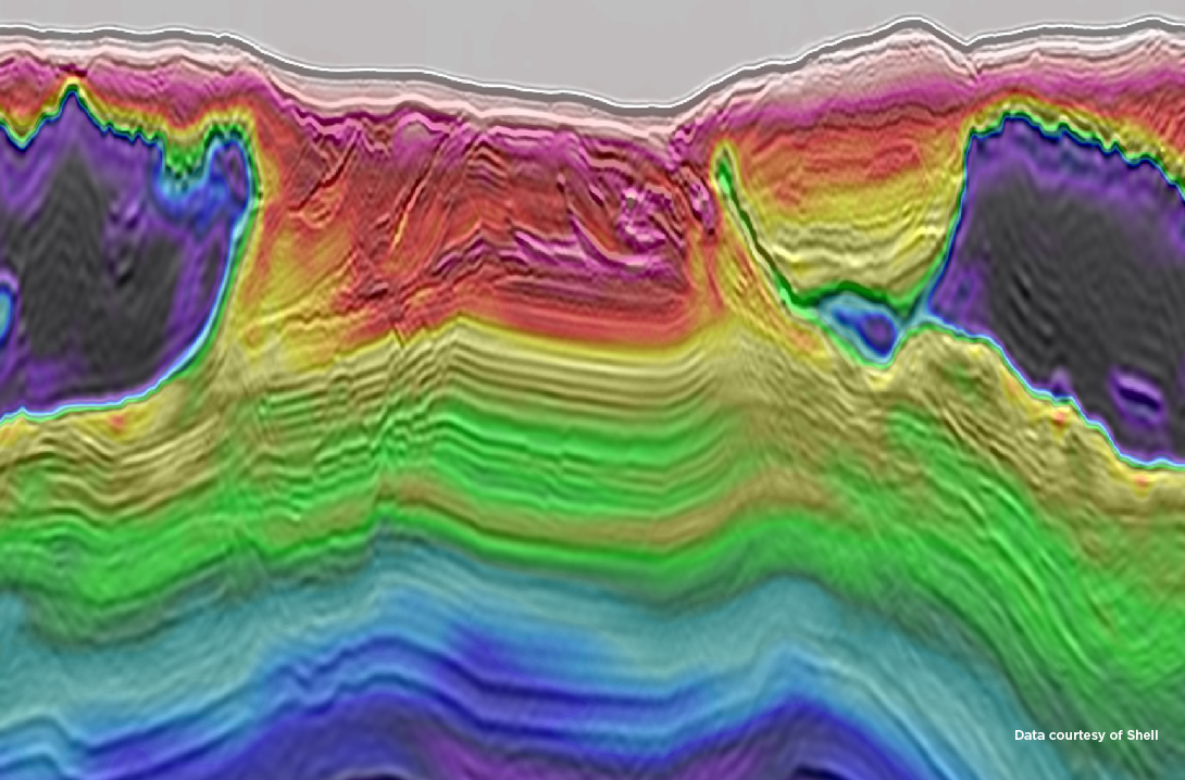
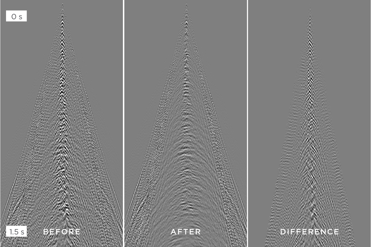
3D receiver gather before and after shot carpet regularisation. (Data courtesy of Shell)
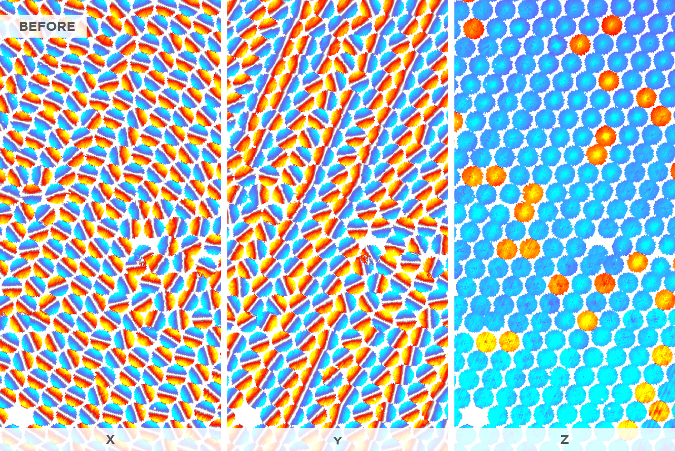
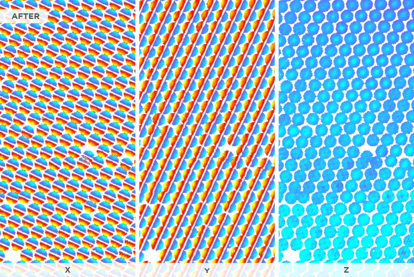
X, Y and Z components before and after rotation QC. We use quaternions to explain the 3-component amplitude distribution given the source-receiver geometry. By exploiting the geophone dipole response and using a statistical analysis we can quickly and efficiently QC every node.
Nodes require fast quality control and parameter determination on a node-dependent basis. With potentially thousands of nodes in a survey, it is essential that a robust, efficient, and automated method is used. It is important that we make the best use of the information recorded on each node; therefore, each node needs more attention than an individual hydrophone on a streamer.
DUG’s OBN Orientation QC workflow simultaneously solves for a range of properties that includes:
Once the derived rotations, receiver shifts and source shifts have been quality controlled, they are easily applied to the data.