Return to projects

Equatorial Guinea MC2D Multi-Client 2D Seismic Survey

FWI enhanced 2D PreSDM seismic reprocessing

DUG in collaboration with Geoex MCG, Perceptum and
Equatorial Guinea’s MHMD

Project Overview

5,658 km - Basin-wide regional well tie 2D seismic reprocessed dataset
Incorporates 2 modern legacy 2D surveys (2005 & 2011) using DUG’s advanced broadband PreSDM workflow including Full Wavefield Inversion
Cutting edge imaging technology: (i) FWI enhanced PreSDM workflows; (ii) Advanced anisotropic model building; (iii) Integration of key producing and frontier wells to anchor the velocity model and improve interpretive confidence; (iv) Simultaneously reprocessed with the Equatorial Guinea MC3D to ensure consistently imaged datasets

Project Highlights

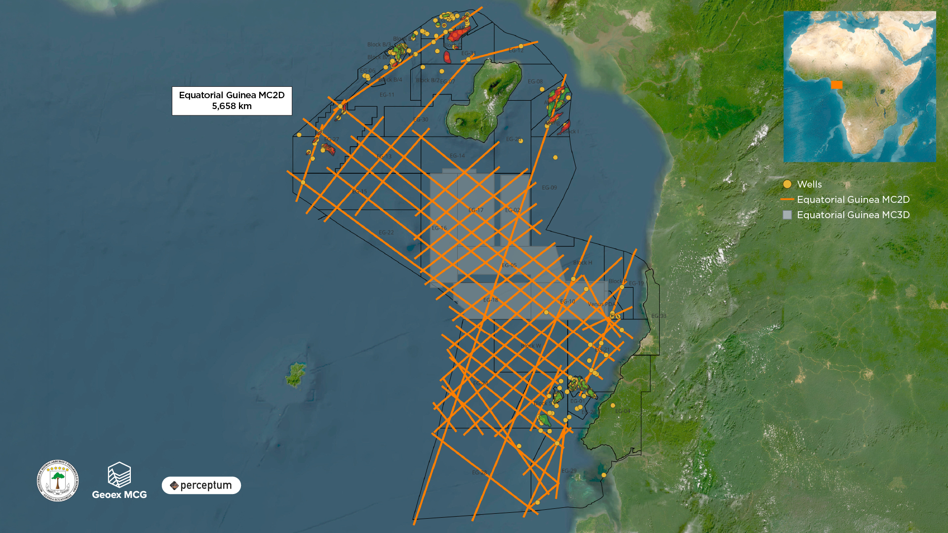
Significantly improved imaging of Miocene and Upper Cretaceous-Paleogene plays, fracture zones, deep structural trends and potential migration pathways

The uplift in seismic imaging marks a step-change in the region’s interpretability and is positioned to become the definitive regional dataset for the offshore Equatorial Guinea

The Ministry of Hydrocarbons and Mining Development, represented by H.E. Minister Mr. Antonio Oburu, has announced the upcoming EGRonda 2026, a new oil and gas licensing round scheduled to launch in April 2026

The Ministry’s open-door policy, which allows companies to directly apply and negotiate contracts with the government, will remain in effect until the launch of EGRonda 2026

Want to discover more about Equatorial Guinea MC2D Multi-Client 2D Seismic Survey

Download Brochure  Contact Multi-Client