Return to projects

Equatorial Guinea MC3D Multi-Client 3D Seismic Survey

Rio Muni and Douala Basins MP-FWI enhanced 3D PreSDM seismic reprocessing

DUG in collaboration with Geoex MCG, Perceptum and
Equatorial Guinea’s MHMD

Project Overview

9,525 sq km – One seamless 3D seismic reprocessed dataset covering 6 prospective blocks
Incorporates 6 legacy 3D surveys using DUG’s advanced broadband Q-PreSDM workflow
All surveys will be matched pre-stack and regularised onto a common grid
To correct for anelastic attenuation and dispersion, we use the power of MP-FWI to invert for Q within the VMB workflow and utilise a Q Kirchhoff Migration in the final imaging
Located over an area that has: (i) Five blocks on offer in the 2016 licensing round; (ii) Underexplored deep-water petroleum systems within the Douala-Rio Muni margin; (iii) Oblique passive margin developed over oceanic crust creates a unique setting for hydrocarbon generation and trapping.

Project Highlights

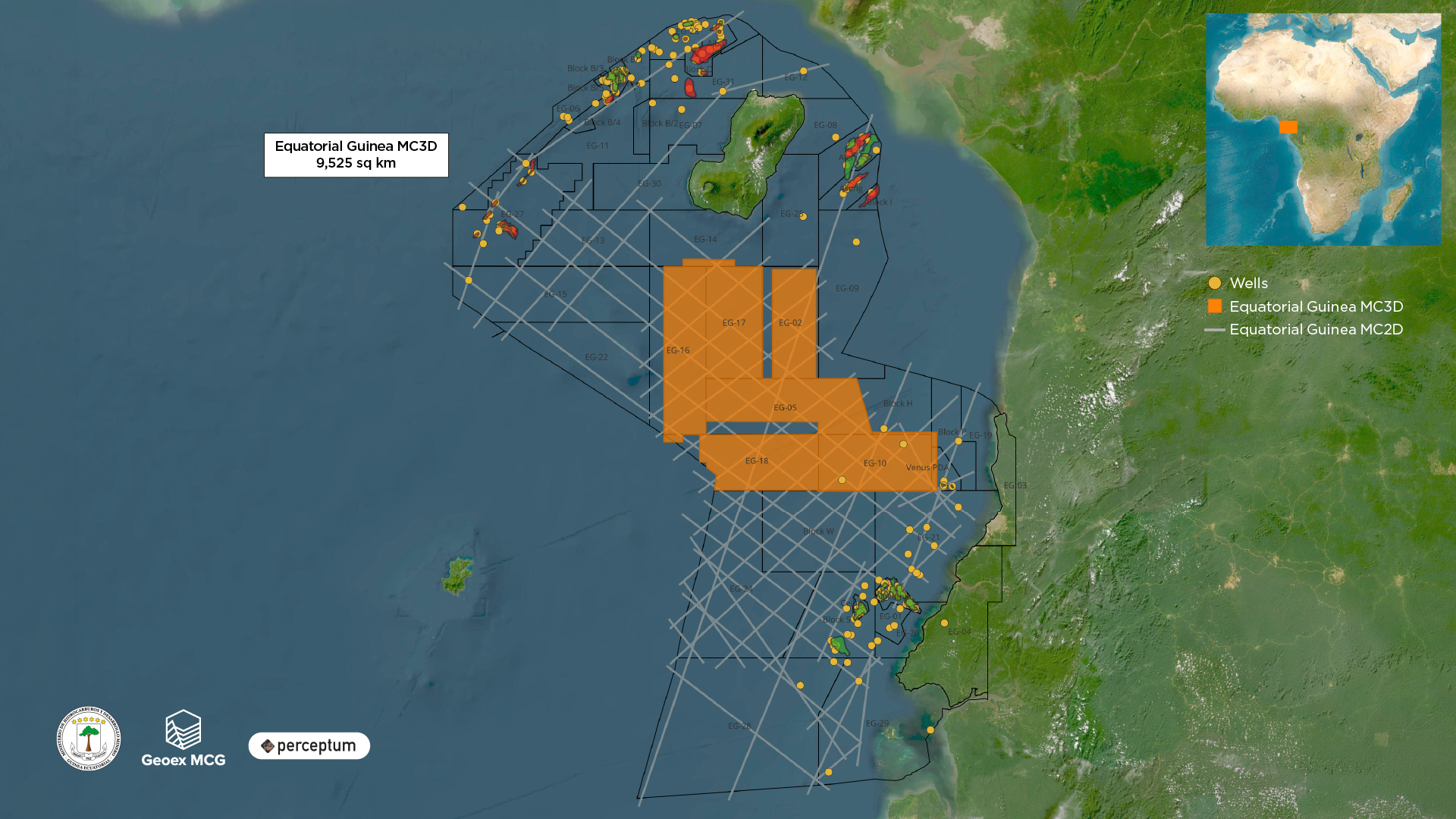
Exploring Equatorial Guinea’s distal hydrocarbon systems down-dip of proven hydrocarbons (oil and gas) in both Lower Miocene and Upper Cretaceous- Paleogene plays

Improved imaging and true amplitude response of turbidite channel / fan systems

The Ministry of Hydrocarbons and Mining Development, represented by H.E. Minister Mr. Antonio Oburu, has announced the upcoming EGRonda 2026, a new oil and gas licensing round scheduled to launch in April 2026

The Ministry’s open-door policy, which allows companies to directly apply and negotiate contracts with the government, will remain in effect until the launch of EGRonda 2026

Want to discover more about Equatorial Guinea MC3D Multi-Client 3D Seismic Survey

Download Brochure  Contact Multi-Client