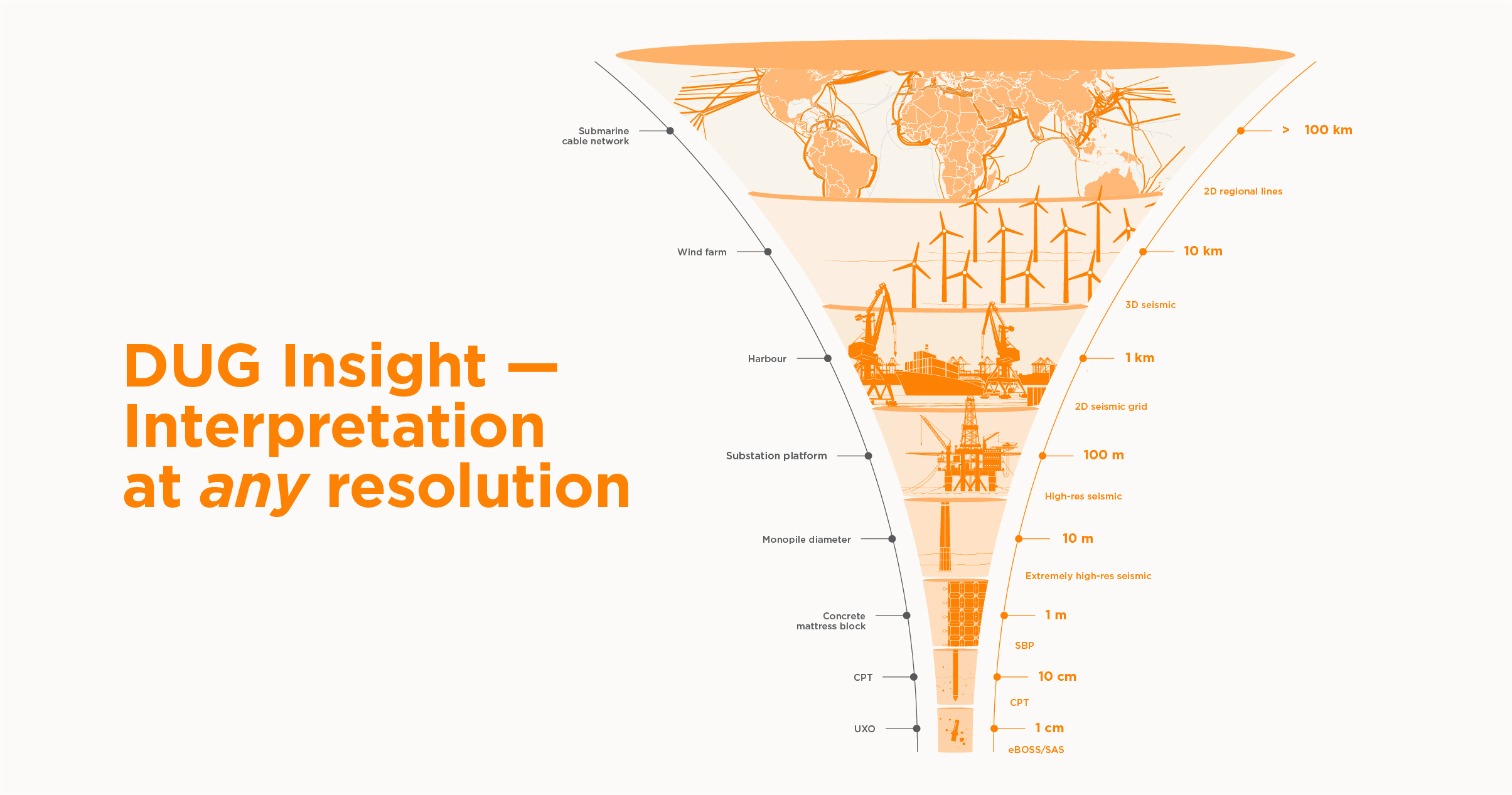
As the energy transition gives rise to larger offshore wind farms, longer subsea cable-routes and higher-resolution site investigations, expectations around ground modelling have evolved. What was once a linear workflow is now a multidimensional challenge involving seabed sonar, sub-bottom profiler (SBP), cone penetration tests (CPT), seismic surveys, and extensive GIS data. Each dataset brings its own unique strengths, scales, and structures; yet, they must converge into a single, coherent model. This demands software capable of interpreting and visualising all sources simultaneously at any resolution.
The shift toward comprehensive site characterisation makes integration essential. Developers need certainty for foundation design, cable-route planners need clearer visibility of shallow hazards, and environmental teams rely on rich data to assess seabed mobility. But when datasets such as seabed sonar, SBP, CPT logs, and 2D/3D seismic remain as silos, the resulting model risks being incomplete or inconsistent. This is often the limitation of legacy tools, which limits the ability to correlate data interactively. As data volumes grow, these silos make it increasingly difficult to keep pace.
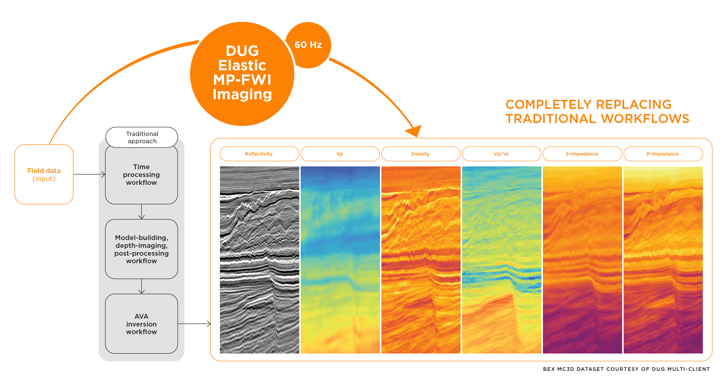
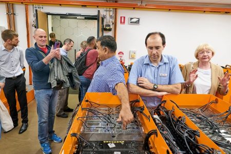
DUG Technology delivers innovative solutions spanning services, software, and high-performance computing. The company’s software, DUG Insight, is a true one-stop geoscience application—handling everything from extremely-high-resolution (EHR) near-surface data to regional-scale seismic within a single workflow.
For over two decades DUG Insight has been an industry-leading package used in over 35 countries, offering a comprehensive suite of interactive tools that support modern geoscience workflows at any resolution.
DUG Insight removes the fragmentation that slows interpretation. Rather than forcing teams to jump packages — for instance one software for mapping, one for seismic, one for SBP, another for CPTs — it combines all core datasets into a unified workspace. Seabed sonar, SBP, CPTs, wells, and GIS can be interpreted and visualised simultaneously, supported by integrated 3D mapping for structures, attributes, hazards, and soil properties. Patterns become more apparent. Spatial relationships are easier to interrogate. Anomalies can be verified against supporting datasets instantly.
The software’s architecture reflects modern project realities. Flexible data management organises large volumes without rigid structures, while direct links to Kingdom™ and Petrel™ projects streamline the transition from legacy interpretations. Because the environment is highly interactive, users receive real-time feedback as parameters are adjusted, masks are applied or attributes are tested. This responsiveness ensures both technical rigour and efficiency when working with dense near-surface data.
Designed by geophysicists, DUG Insight does not assume that interpretation begins in one domain and ends in another. Instead, it treats the full spectrum of inputs — single-channel, multi-channel, sub-bottom, seismic, wells, GIS and more — as essential contributors to the ground model, improving efficiency and consistency.
As subsea infrastructure scales in size and complexity, ground modelling can no longer be a series of disconnected tasks. Critical decisions depend on understanding how centimetre-scale features in SBP or CPT data relate to metre-scale seabed morphology and kilometre-scale geological trends. DUG Insight bridges these scales, allowing geoscientists to move seamlessly from extremely-high-resolution detail to regional context without losing continuity or confidence.
“By unifying eBOSS, SBP, CPTs, wells, GIS and seismic within a single, interactive workspace, DUG Insight enables teams to see the full picture as a connected model,” says Margarita Kongawoin, SVP of Software & HPC at DUG “This reduces uncertainty, shortens iteration cycles, and improves collaboration. In an era of tight timelines, the ability to interpret across scales in one environment is no longer a luxury — it is a necessity for delivering defensible ground models for the next generation of energy projects.”